Consular Processing: Monday to Friday, 9:00 AM – 4:00 PM
Press Release
PHILIPPINE CONSULATE GENERAL IN CHICAGO RECEIVES HUNDREDS OF PHILIPPINE MAPS FROM AUGUSTANA COLLEGE

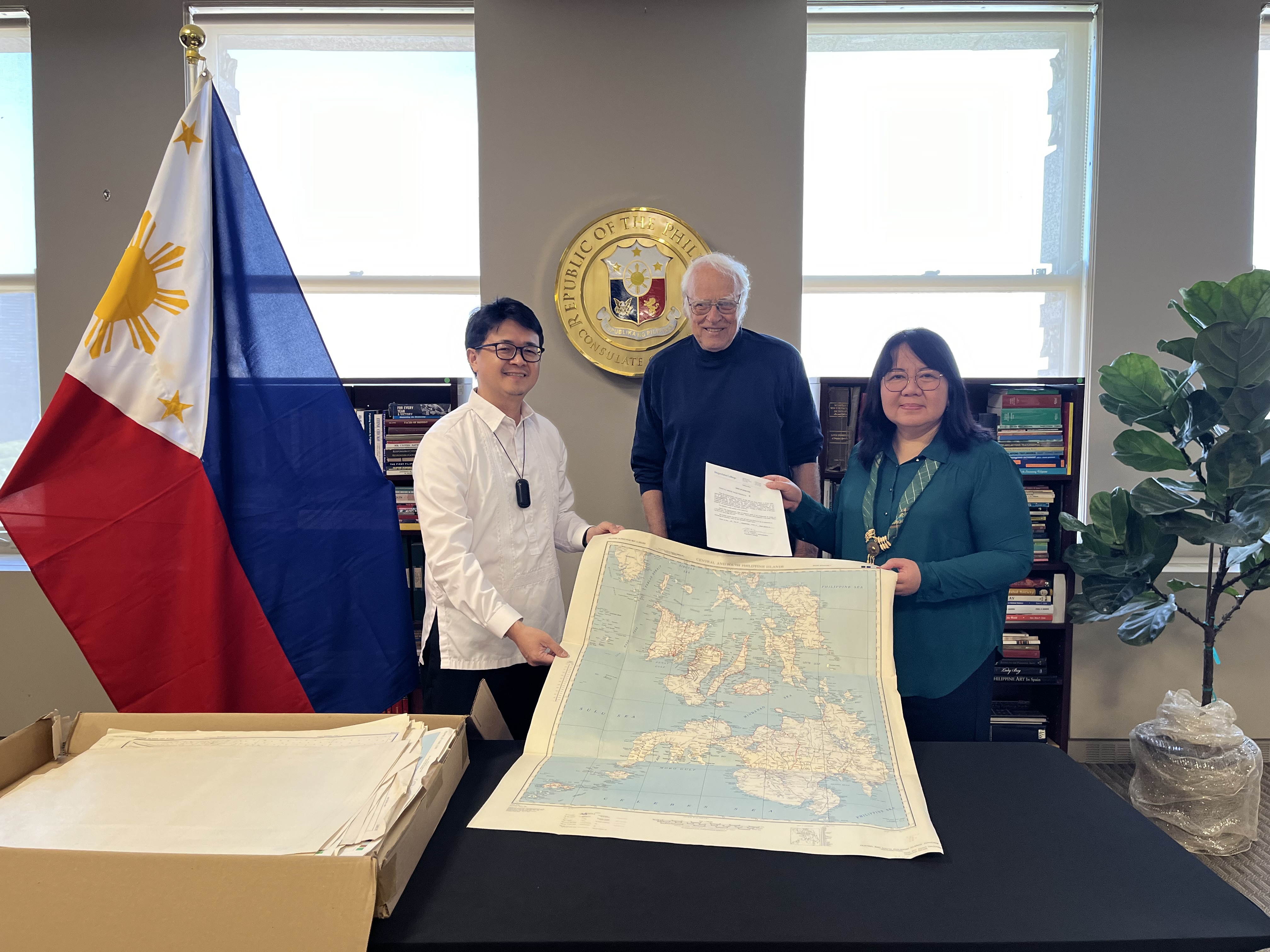
Consul General J. Susana V. Paez (right) poses with Dr. Norm Moline (center) and Consul Ryan Gener (left) while holding the deed of donation and one of the maps turned over by Augustana College. (Photo: Chicago PCG/Kath Lobien)
11 September 2024 (Chicago) – With the supervision of the Philippine Embassy in Washington, D.C., the Philippine Consulate General in Chicago, led by Consul General J. Susana V. Paez, received a donation of seven hundred thirty-five (735) maps pertaining to the Philippine archipelago and its localities from Augustana College at the Kalayaan Hall of the Philippine Consulate on 09 September 2024.
The maps, which were produced by the US Army Map Service in the 1940s, were personally delivered and handed over by Dr. Norman Moline, Professor Emeritus of Geography at Augustana College, which is located in Rock Island, Illinois, and formalized through a deed of donation signed by the College’s Vice President for Finance and Administration Kirk Anderson.
The turnover was timely as the Philippines is commemorating the Maritime and Archipelagic Nation Awareness Month (MANA Mo) in September with the theme “Pamana ng Karagatan: Para sa Kinabukasan, ating Ingatan”.
Beyond the typical country or regional maps visualizing the 7,641 islands of the Philippines and its surrounding waters, a bulk of the maps go into geographic detail of particular cities, towns, inland lakes and rivers, inter-island seas, and many of the reefs and shoals located in the western, southern and eastern frontiers of the archipelago. They also tell a story of the rich historical ties between the Philippines and the United States that have molded continuously strengthening relations that bode well for the future of the archipelago.
One map entitled “Philippines (North) Special Strategic Map” included the Scarborough Shoal off the western coast of the Ilocos region, while other maps included features belonging to the Spratly Islands near Palawan, Union, Tarlac and other reefs near Quezon and Bicol Provinces, and the Meridian, Frances and other reefs in the Sulu Archipelago down south, displaying the rich archipelagic features of the country.
The maps, most of which were first edition duplicate originals prepared in 1943 and 1944, were produced mainly to prepare for reclaiming and liberating the Philippines from Japanese occupation during World War II. The map index indicates that the areas surveyed were mostly coastal areas, but as Dr. Moline noted, also included inland areas in anticipation of the military push inward from shorelines. Key maps include several maps of Leyte, including Palo (where the monumental Leyte Landing of President Sergio Osmeña and General Douglas MacArthur occurred on 20 October 1944), nearby Tacloban City and the town of Dulag, just south of Palo where the annotation “Suitable for Troops” was stated on the map.
Overall, there are more than a hundred maps in the collection detailing various locations in the provinces of Leyte and Samar, likely in preparation for said landing. These include naval and astronomical stations, road and telegraph line conditions, terrain and elevation, and in the waters likely targeted for landing, annotations on strength of currents, rip tides and conditions during high and low tides.
Dr. Moline explained that while an original set is with the Library of Congress, another set was provided to Augustana College since a member of its faculty then, Dr. Fritiof Fryxell, was a distinguished geologist for the war effort in the Pacific. Consul General Paez and Dr. Moline agreed on the importance of preserving maps, with Consul General Paez noting their significance in defining the international legal regime, while Dr. Moline cited their role in history and culture. The maps were based on earlier surveys and censuses complemented by intelligence information. Dr. Moline also marveled at the speed by which the maps were produced by the US Army Map Service given the stakes at hand.
Dr. Moline also shared his fondness for the Philippines, sharing visits in 1977 and 1980 to among other places the International Rice Research Institute in Los Baños, Banaue Rice Terraces and Corregidor Island, and recognized the geographic importance of the Philippines as a food resource.
The donation was coordinated initially by Augustana College with the Philippine Embassy in Washington, D.C. and the U.S. Library of Congress, and consummated with the Philippine Consulate with the supervision of the Philippine Embassy. END

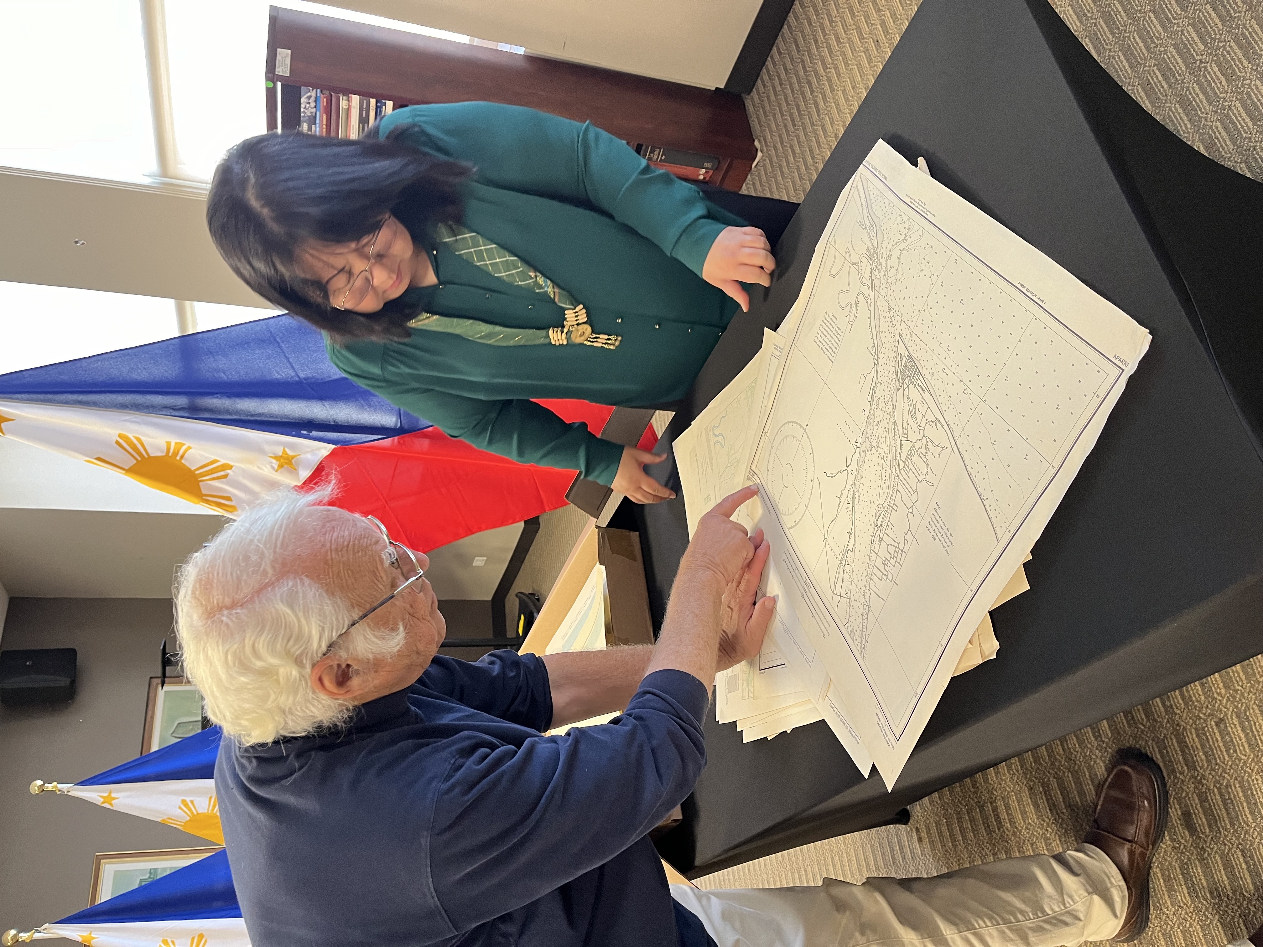
Dr. Moline (left) discusses details of one of the maps with Consul General Paez. (Photo: Chicago PCG/Kath Lobien)

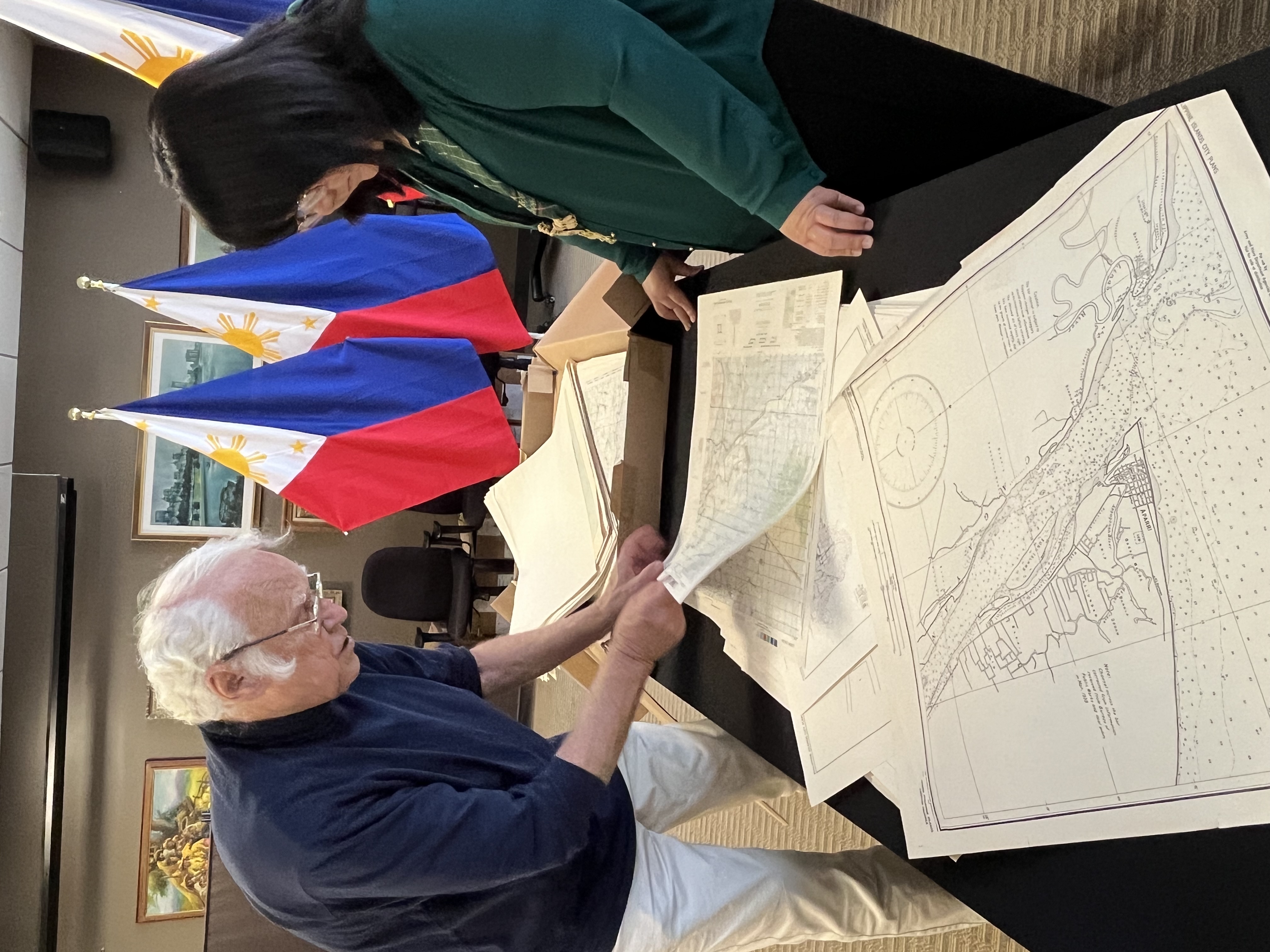
Dr. Moline skims through other maps in the collection as Consul General Paez looks on. (Photo: Chicago PCG/Kath Lobien)

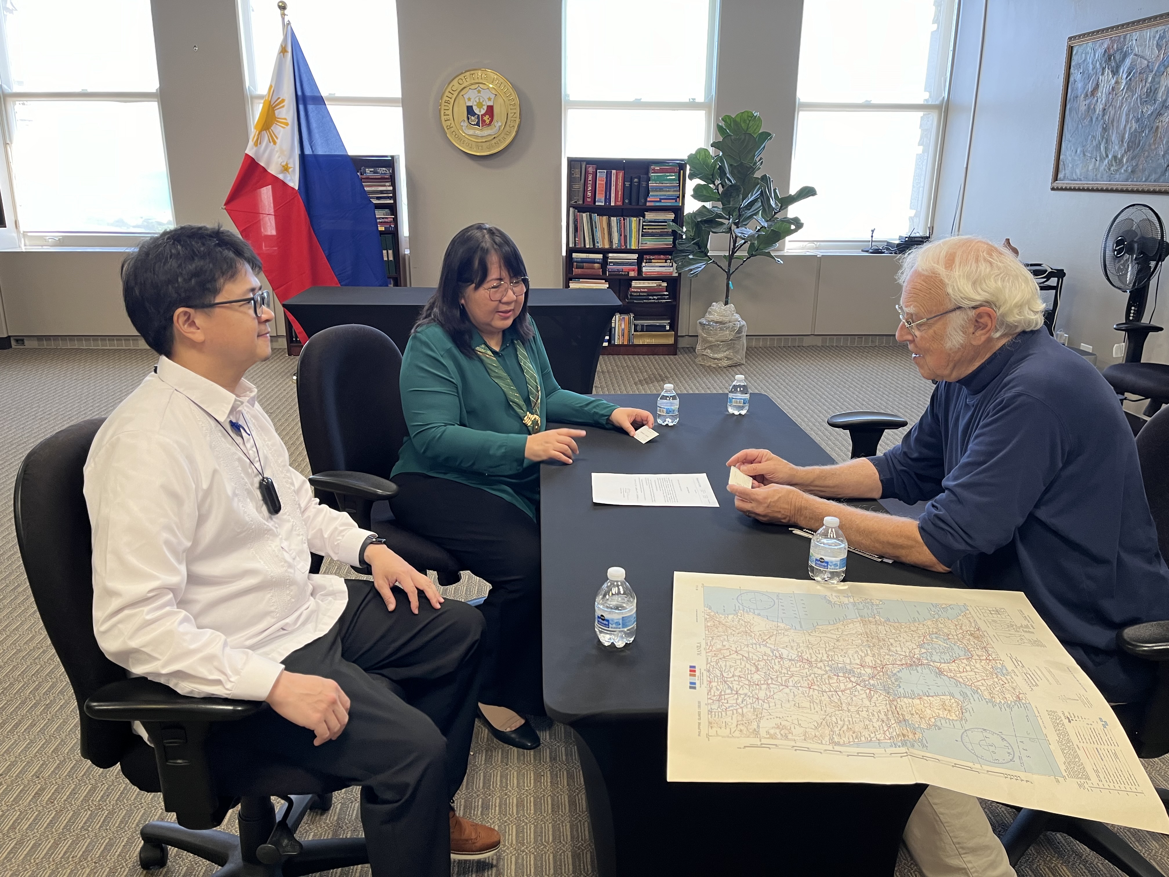
Consul General Paez (middle) discusses the map donation with Dr. Moline (right) as Consul Gener (left) looks on. (Photo: Chicago PCG/Kath Lobien)

11 September 2024 (Chicago) – With the supervision of the Philippine Embassy in Washington, D.C., the Philippine Consulate General in Chicago, led by Consul General J. Susana V. Paez, received a donation of seven hundred thirty-five (735) maps pertaining to the Philippine archipelago and its localities from Augustana College at the Kalayaan Hall of the Philippine Consulate on 09 September 2024.
The maps, which were produced by the US Army Map Service in the 1940s, were personally delivered and handed over by Dr. Norman Moline, Professor Emeritus of Geography at Augustana College, which is located in Rock Island, Illinois, and formalized through a deed of donation signed by the College’s Vice President for Finance and Administration Kirk Anderson.
The turnover was timely as the Philippines is commemorating the Maritime and Archipelagic Nation Awareness Month (MANA Mo) in September with the theme “Pamana ng Karagatan: Para sa Kinabukasan, ating Ingatan”.
Beyond the typical country or regional maps visualizing the 7,641 islands of the Philippines and its surrounding waters, a bulk of the maps go into geographic detail of particular cities, towns, inland lakes and rivers, inter-island seas, and many of the reefs and shoals located in the western, southern and eastern frontiers of the archipelago. They also tell a story of the rich historical ties between the Philippines and the United States that have molded continuously strengthening relations that bode well for the future of the archipelago.
One map entitled “Philippines (North) Special Strategic Map” included the Scarborough Shoal off the western coast of the Ilocos region, while other maps included features belonging to the Spratly Islands near Palawan, Union, Tarlac and other reefs near Quezon and Bicol Provinces, and the Meridian, Frances and other reefs in the Sulu Archipelago down south, displaying the rich archipelagic features of the country.
The maps, most of which were first edition duplicate originals prepared in 1943 and 1944, were produced mainly to prepare for reclaiming and liberating the Philippines from Japanese occupation during World War II. The map index indicates that the areas surveyed were mostly coastal areas, but as Dr. Moline noted, also included inland areas in anticipation of the military push inward from shorelines. Key maps include several maps of Leyte, including Palo (where the monumental Leyte Landing of President Sergio Osmeña and General Douglas MacArthur occurred on 20 October 1944), nearby Tacloban City and the town of Dulag, just south of Palo where the annotation “Suitable for Troops” was stated on the map.
Overall, there are more than a hundred maps in the collection detailing various locations in the provinces of Leyte and Samar, likely in preparation for said landing. These include naval and astronomical stations, road and telegraph line conditions, terrain and elevation, and in the waters likely targeted for landing, annotations on strength of currents, rip tides and conditions during high and low tides.
Dr. Moline explained that while an original set is with the Library of Congress, another set was provided to Augustana College since a member of its faculty then, Dr. Fritiof Fryxell, was a distinguished geologist for the war effort in the Pacific. Consul General Paez and Dr. Moline agreed on the importance of preserving maps, with Consul General Paez noting their significance in defining the international legal regime, while Dr. Moline cited their role in history and culture. The maps were based on earlier surveys and censuses complemented by intelligence information. Dr. Moline also marveled at the speed by which the maps were produced by the US Army Map Service given the stakes at hand.
Dr. Moline also shared his fondness for the Philippines, sharing visits in 1977 and 1980 to among other places the International Rice Research Institute in Los Baños, Banaue Rice Terraces and Corregidor Island, and recognized the geographic importance of the Philippines as a food resource.
The donation was coordinated initially by Augustana College with the Philippine Embassy in Washington, D.C. and the U.S. Library of Congress, and consummated with the Philippine Consulate with the supervision of the Philippine Embassy. END


