Consular Processing: Monday to Friday, 9:00 AM – 4:00 PM
Press Release
PHILIPPINE CONSULATE GENERAL IN CHICAGO VIEWS CENTURIES-OLD MAPS OF THE PHILIPPINE ARCHIPELAGO AT THE NEWBERRY LIBRARY

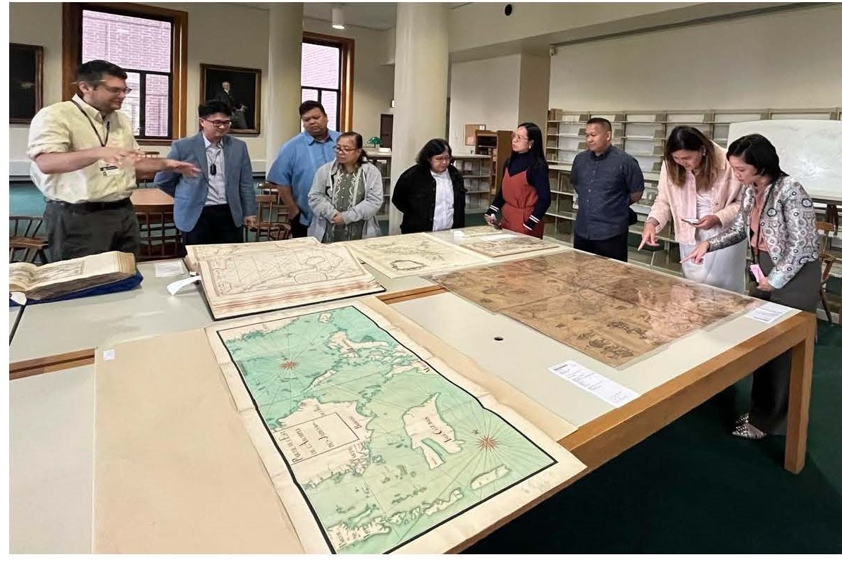
(Left) (Left) Newberry Curator of Maps David Weimer (left) provides an overview of the Philippine map collection at the library as (L-R) Consul Ryan Gener, Jerwin Mamamlateo, Marivic Rivera, Cynthia Acaba, Cheryl Navarro, Martyn Orcine, Consul Ella Mitra and Mary Joy Duran-Mortel (who stand in front of a 1734 Murillo Velarde-Bagay map) listen. (Photo: Chicago PCG/Kath Lobien)
02 October 2024 (Chicago) – Philippine Consulate General personnel visited the Newberry Library in Chicago on 27 September 2024 to view about a dozen maps of the Philippine archipelago published from the 17th to the 19th centuries, which forms part of hundreds of Philippine maps in the library’s collection.
The visit was made as part of the Philippine Consulate’s commemoration of Maritime and Archipelagic Nation Awareness Month (MANA Mo), with the theme “Pamana ng Karagatan: Para sa Kinabukasan, ating Ingatan” and in recognition of the importance of the maps in recording and safeguarding the heritage of the Philippine archipelago and its surrounding seas.
Newberry Curator of Maps and Director of the Hermon Dunlap Smith Center for the History of Cartography, Mr. David Weimer, provided an overview of the selected maps, which were produced from 1658 to 1852, and some context on how they were produced. He noted the evolution of the maps from a more general depiction to a more precise and detailed portrayal of the archipelago.
Philippine Consulate officials observed that while the maps produced by various Spanish, British, French, and Dutch cartographers had indeed become more detailed and scientific over time, there were common elements that were consistently part of the maps, including maritime and archipelagic features that are more widely known to be depicted in the 1734 Murillo Velarde map, which is also part of the Newberry’s storied collection.
Mr. Weimer shared the Philippine collection at the Newberry Library can be accessed by the public upon registration, and urged researchers and map enthusiasts to take a closer look at them. The Newberry Library houses hundreds of thousands of maps, and is home to the largest collection of manuscripts of Dr. Jose P. Rizal outside the Philippines. END

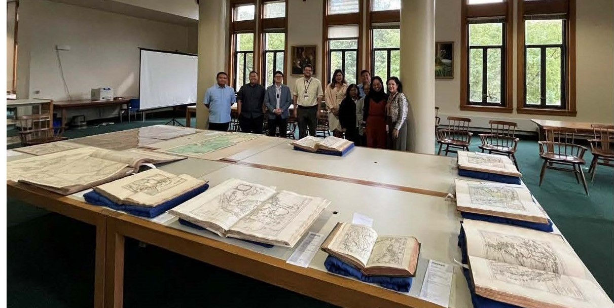
Philippine Consulate personnel pose behind the maps with Newberry Library curator.
(Photo: Chicago PCG/Kath Lobien)

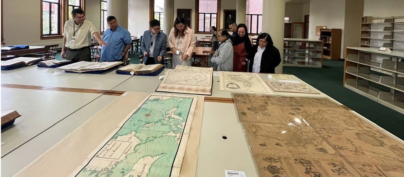
Mr. Weimer (left) emphasizes a point while explaining a detail in one of the maps to Philippine Consulate personnel. (Photo: Chicago PCG/Kath Lobien)

02 October 2024 (Chicago) – Philippine Consulate General personnel visited the Newberry Library in Chicago on 27 September 2024 to view about a dozen maps of the Philippine archipelago published from the 17th to the 19th centuries, which forms part of hundreds of Philippine maps in the library’s collection.
The visit was made as part of the Philippine Consulate’s commemoration of Maritime and Archipelagic Nation Awareness Month (MANA Mo), with the theme “Pamana ng Karagatan: Para sa Kinabukasan, ating Ingatan” and in recognition of the importance of the maps in recording and safeguarding the heritage of the Philippine archipelago and its surrounding seas.
Newberry Curator of Maps and Director of the Hermon Dunlap Smith Center for the History of Cartography, Mr. David Weimer, provided an overview of the selected maps, which were produced from 1658 to 1852, and some context on how they were produced. He noted the evolution of the maps from a more general depiction to a more precise and detailed portrayal of the archipelago.
Philippine Consulate officials observed that while the maps produced by various Spanish, British, French, and Dutch cartographers had indeed become more detailed and scientific over time, there were common elements that were consistently part of the maps, including maritime and archipelagic features that are more widely known to be depicted in the 1734 Murillo Velarde map, which is also part of the Newberry’s storied collection.
Mr. Weimer shared the Philippine collection at the Newberry Library can be accessed by the public upon registration, and urged researchers and map enthusiasts to take a closer look at them. The Newberry Library houses hundreds of thousands of maps, and is home to the largest collection of manuscripts of Dr. Jose P. Rizal outside the Philippines. END


